The sacred valley of the Inca is an extension of the heart of the Inca culture which is the city of Cusco. Thus the valley is the "heartland" of the Inca. However, the "valley" is more than the valley of the Urubamba River which flows through the cities of Urubamba, Ollantaytambo and Aguas Calientes (seen in the Google relief map below). The valley also includes the farm land on the high lands; such as by Chinchero, and the river valleys to the west of Pisaq.

The valley of the Urubamba River declines sharply as the river flows westward. By the time the waters reach Aguas Calientes (where Machu Picchu is located), the river is ferocious (we visited at the end of the rainy season). The agricultural richness of the Urubamba River valley is highlighted by the extensive corn grown through the valley. In the highlands around Chinchero, the main crops are potatoes and quinua.

The day-long tour passed through the Inca homeland with stops at three chosen archeological sites (the valley is replete with archological sites). Above, Julie waits for our tour van in front of the hotel with a traditional Inca doorway, and Harold waits by our tour bus.


Here is a view of the small village of Pisaq (often considered the start of the Sacred Valley). We visited the fortress, temple and cemetery located on the mountain side above the city.


After our visit to the archeological site, we visited the Pisaq Market and enjoyed a bread snack from the above baker and watched a silversmith practice his profession. Julie happily bought a silver bracelet from him.

After our visit to Pisaq, we stopped at this restaurant for our buffet-style noon meal and were there before the big rush when more buses arrived. This business is a good example of the impact the tourist industry has on the valley.


Looking up the "hill" to the top of the fortress and temple site. We were awed by the view and were also thinking about our walk required to get to the top. Puff. Puff. (and puff some more)

As we walked to the top, we could see structures to the sides. These niches in the walls would have been used to display various god icons.


The structures on top were never completed. Here is a huge stone left on an incline, and it still has the protrusions to which ropes would have been fastened. The "fasteners" would have been removed when the stone was in the intended position.

This picture was taken from Wikipedia and shows what is thought to be a backdrop for an intended temple to the sun. The six slabs of stone are of a pink granite that is not found locally. The backdrop is not finished.


The surrounding mountain tops were as interesting to observe as the top site at Ollantaytambo. The white area to the right of the peak is the quarry used for most of the stones in the building of the temple and fortress. We were told there are abandoned stones that mark the way from the quarry to the top of Ollantaytambo.


We also visited the remains of the Incan temple and plaza at Chinchero. We were interested to learn there is a proposal to build an international airport in the area as this agricultural area provides space and is close to Cusco and, of course, to Machu Picchu. As you might expect, the locals had mixed opinions about this planned airport.


Beneath the natural stones at Q'enqo is a "cave" that was used to honor Mother Earth, but is also thought to have been used as a mortuary because of the table structures and natural coolness in the "cave". The shape of the image you see is also thought by some not to be an accident. It appears to be the head of a llama (note the same image inserted on the lower right hand corner that has been rotated 90 degrees).
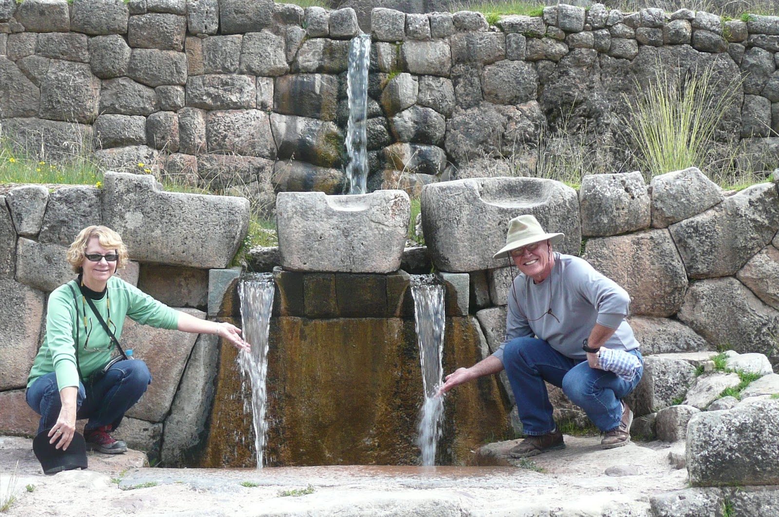
Who is good and who is evil in the waterfall picture? I'd like to find out before your arrival back in the US.
ReplyDeleteAlso, I was told that the cave's table was used for ceremonial sacrifices. The sacrifices were thought to be for Mother Earth (Pachamama?) due to their womb-esque location?!?